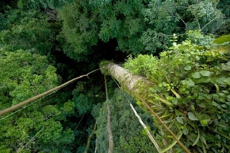

Combination of satellite images and on-the-ground data enables more complete tracking of forest carbon flows.
Get Started for FREE
Sign up with Facebook Sign up with X
I don't have a Facebook or a X account


 Your new post is loading...
 Your new post is loading...
Your new post is loading...
Combination of satellite images and on-the-ground data enables more complete tracking of forest carbon flows. 
No comment yet.
Sign up to comment
|

Whale poo could be the secret to reversing the effects of climate change. Via Marian Locksley, PIRatE Lab
PIRatE Lab's insight:
So whales can be seen as an ecosystem service. In this case, a force to sequester carbon. By saving whales from extinction we (in effect) saved this important function which "rockets" carbon from surface waters (such as krill or other plankton) into deeper waters as speed many orders of magnitude greater than the normal settling rate of typical marine snow.

PIRatE Lab's curator insight,
July 8, 2014 8:13 PM
Its all about trying to transport carbon from the surface down to the sediments down deep in the benthos...although "reversing" climate change is a bit overly optimistic. |